Your browser (Internet Explorer 7 or lower) is out of date. It has known security flaws and may not display all features of this and other websites. Learn how to update your browser.
X

|
MAPPING OF FLOODED AREAS
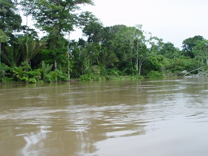
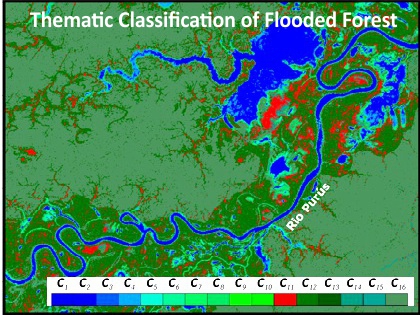
| Based on digital processing technologies, radar (Synthetic Aperture Radar) images interpretation consists in a very important tool for flooding delineation in regions highly sensitivity such as: rain forest areas, flat areas of occupied by populations, forest areas crossed by pipelines. This technique has been widely used in regions of tropical rainforest where detection of images operating in the optical and infrared range is extremely restricted. Products derived from this highly relevant technology are useful for mapping and monitoring pipelines paths as well as for seasonal delineation of rivers, lakes and forest areas. |
|
|
GEOSPATIAL PETROLEUM
Tel: +55 (21) 98899-7939
|
© Copyright 2014
GEOSPATIAL PETROLEUM
|